
Hanover’s Perspective
Hanover County Takes to the Sky to Market Strategic Sites
It’s no secret that drones, also known as unmanned aerial vehicles or UAVs, are being used for many purposes. From media use to delivering packages, drones are a breakthrough technology with seemingly endless commercial applications.
“In the county’s effort to better market its prime commercial and industrial sites in the most cost effective manner, the use of drone footage became the obvious solution,” said Linwood Thomas, director of Hanover County Economic Development (HCED). “The logistical challenges of business executives personally visiting prospective sites can be prohibitive, so these drone productions are invaluable for showing the location and assets of a property.” These strategic sites are located within the county’s Suburban Services Area and are allocated for commercial investment in Hanover’s Comprehensive Plan.
“Giving a bird’s eye view of our prime sites including their proximity to major roadways, interstates, rail service, ports, neighboring businesses and utilities is a wonderful visual aid to our prospective clients,” explains Susan Deusebio, deputy director, who was instrumental in coordinating the drone shoots with land owners, brokers and the production company.
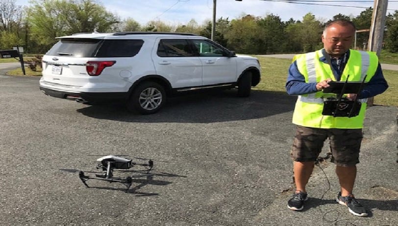
Richard MacDonald of New Media Systems, a licensed pilot with more than 17 years of experience and 4,500 of logged flying time, used his advanced remote control drone to capture the flyover footage for all of the department’s featured site videos. His company completed production by adding text narrative, points of interest and musical accompaniment.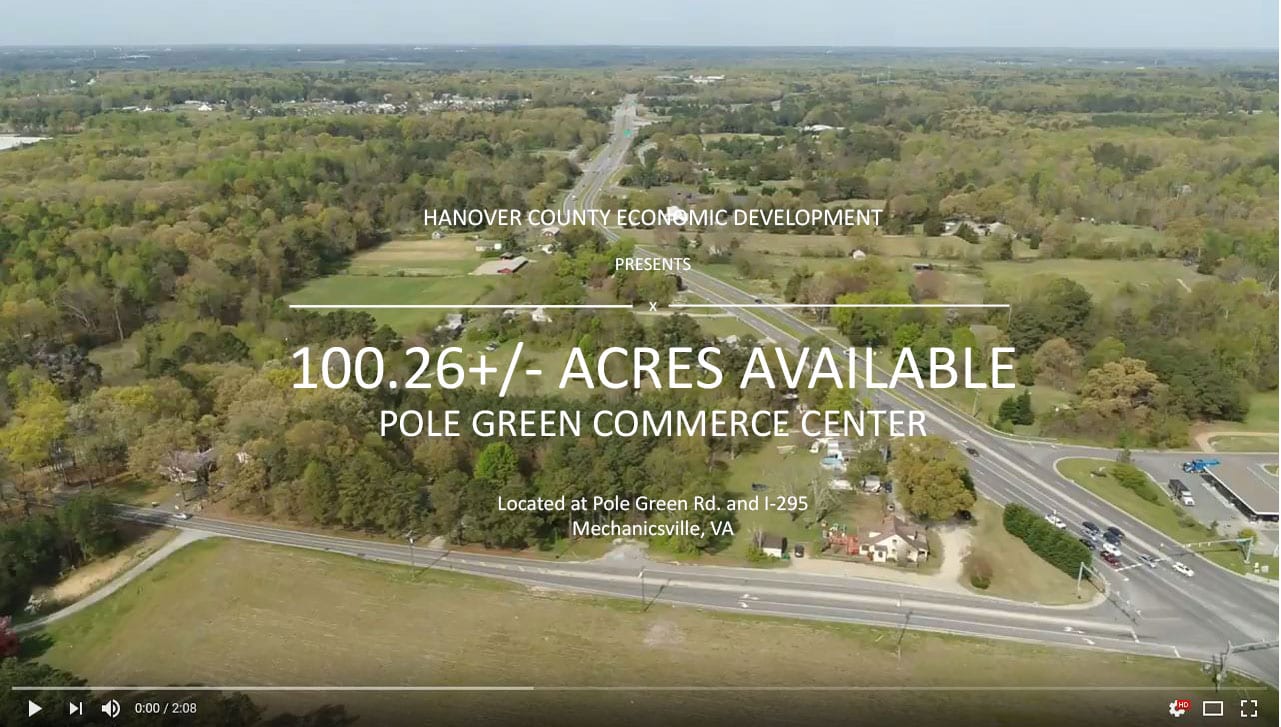
The drone videos are now included on six listings found on the Featured Sites page on the department’s website with rotation planned on HCED’s social media platforms. They can also be found on the department’s YouTube channel along with Testimonial videos.
Hanover County Economic Development continually strives to incorporate innovative technology to position the county for new business investment. In addition to drone videos, the department also offers the use of a powerful GIS tool on its website as a site selection aid. The GIS tool, also known as ZoomProspector, had additional features that provide dynamic real estate, demographic and industry breakdowns along with consumer spending, wage and labor force data.